Smart & Sustainable Agriculture Solutions
We support smart and sustainable agriculture solutions that reduce water consumption and improve agricultural productivity in Iraq's challenging climate.
Built for Iraq's Climate
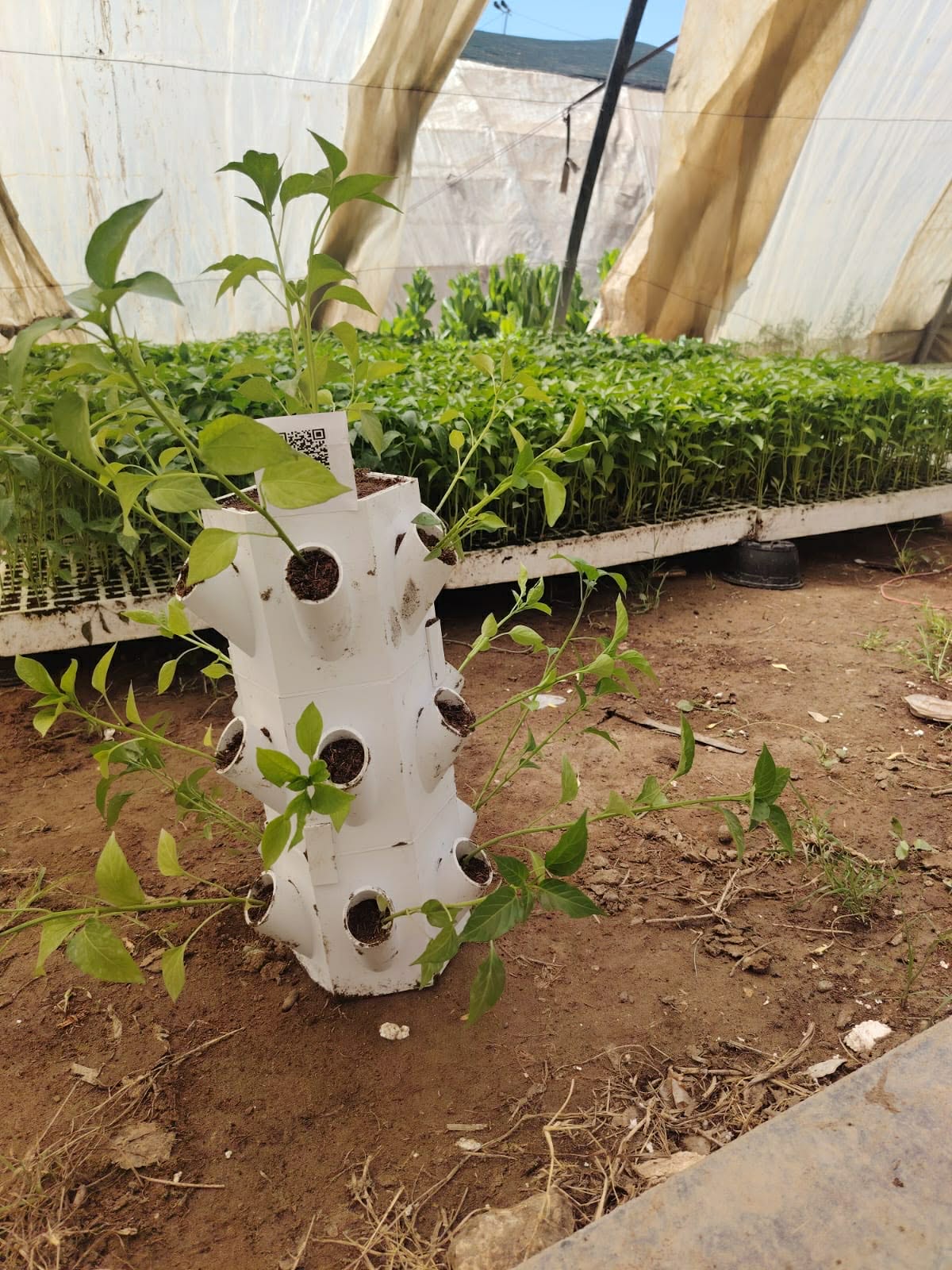
Smart Vertical Farming from Recycled Plastic
Smart Vertical Farming Systems made from recycled plastic — designed to maximize yield while minimizing water usage in drought-affected areas.
- Vertical farming system designs
- Training workshops on plastic recycling using 3D printing
- Education for farmers on how to build these systems themselves
- Water consumption reduction solutions
- Increased productivity in drought-affected areas
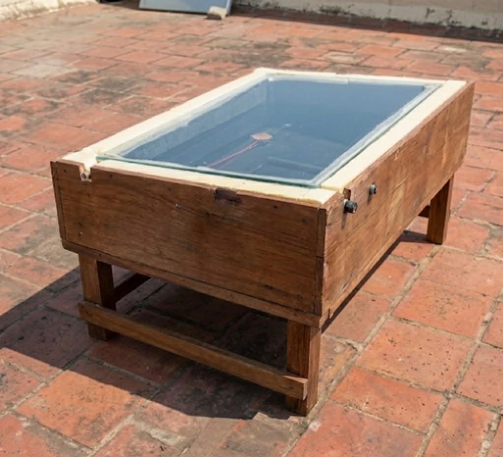
Solar Distillation Water-Treatment Systems
Designed for dry regions relying on salty groundwater wells — converting unusable water into clean irrigation water using solar energy.
- Solar distillation system designs for water treatment
- Converting salty groundwater into usable irrigation water
- Training users on operating and managing these systems
- Workshops for building integrated water treatment systems
- Engineering consultation for water management and agriculture
Addressing Iraq's Water & Food Security Crisis
Iraq faces increasing drought frequency, saline groundwater, and reduced agricultural productivity. Our products are engineered specifically for these conditions — practical, affordable, and deployable without advanced infrastructure.
Water Efficiency
Dramatically reduced irrigation consumption
Circular Economy
Plastic waste repurposed into productive assets
Solar-Powered
Off-grid solutions for rural Iraq